Śródmieście

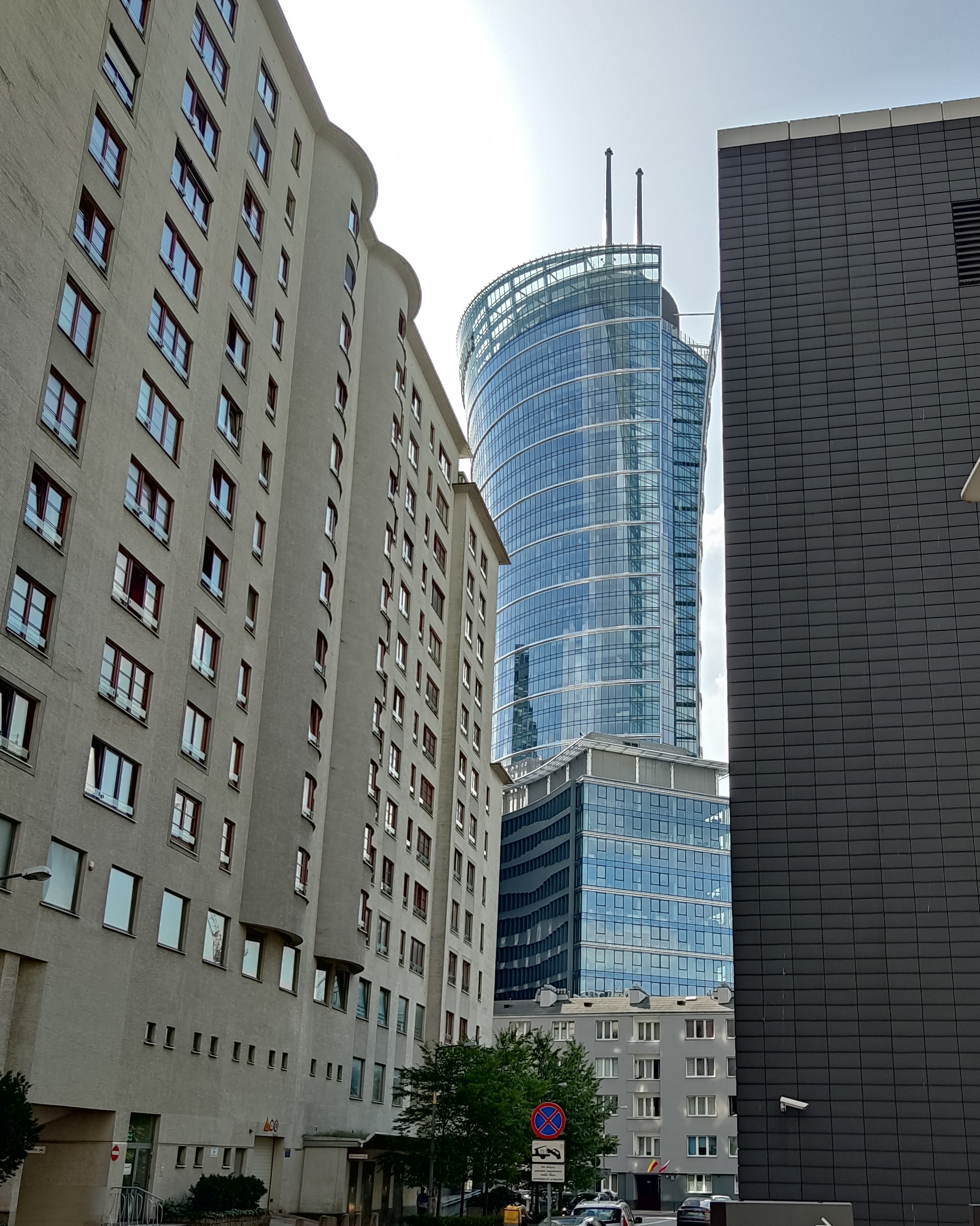
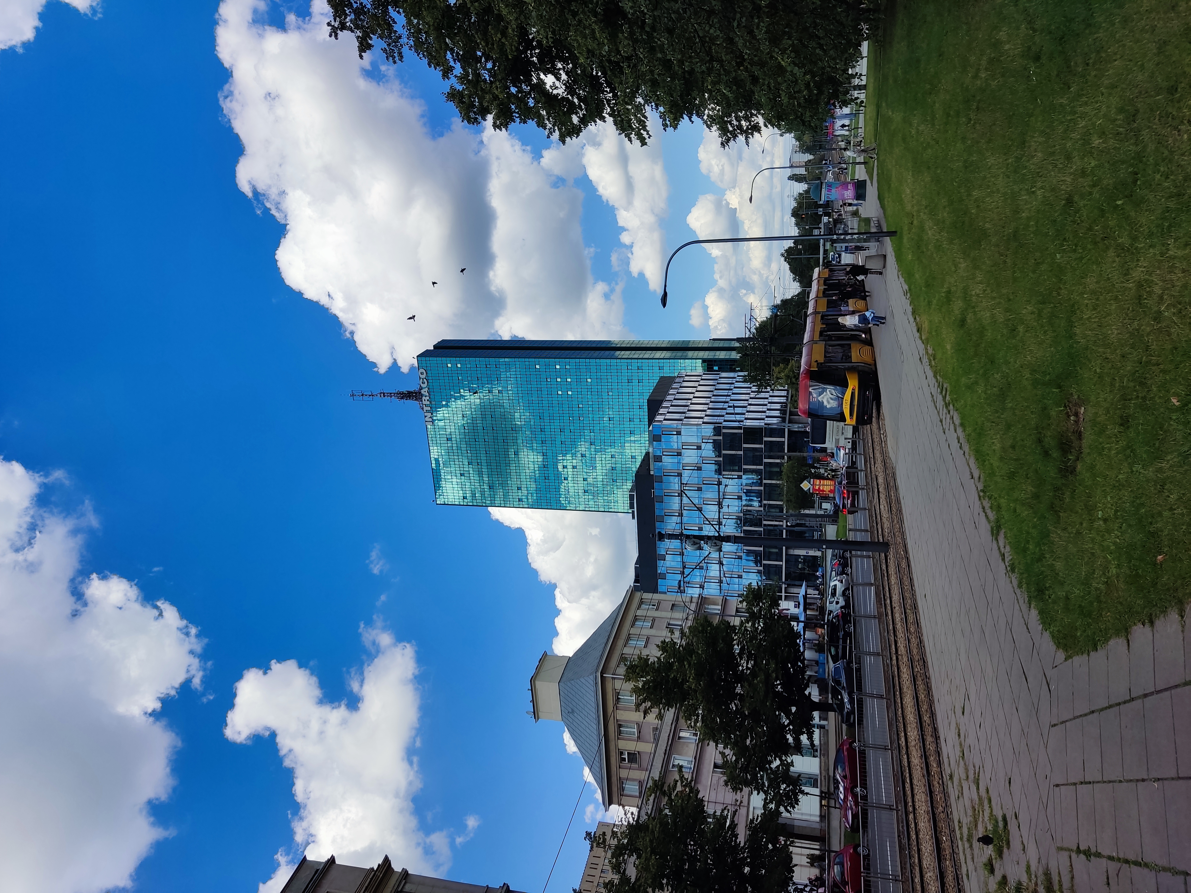
Śródmieście is a district of Warsaw, located on the left bank of the city. This is one of the 18 districts of the capital.
The borders of Śródmieścia were established in 1960 (before the Second World War, this also included the eastern regions of the current Wola and Ochota). Śródmieście includes the oldest part of Warsaw ((Stare Miasto and Nowe Miasto). In the period 1994–2002, there was a commune Warszawa-Centrum, covering Śródmieście and 6 other districts - the boundaries of this commune approximately coincided with the pre-war borders of Warsaw.
Currently, the boundaries of the district are marked by railway lines along the street. Słomińskiego, al. Jana Pawla II, al. Niepodległości, st. Spacerowa, st. Gagarina, st. Podchorążych and nurt Wisły.
Śródmieście covers the oldest part of Warsaw, so most of the buildings of outstanding historical importance are located here, especially in Starym Mieście and along Trakcie Królewskim. However, the destruction during the Second World War resulted in numerous damages to the urban fabric, which were later patched up by modern buildings, especially in Muranowie, but also in other areas of Śródmieścia.
According to TERYT (National Official Register of Territorial Division of Poland), the Śródmieście area includes 505 streets and is divided into 9 following microdistricts:
Latawiec
Mariensztat
Mirow
Muranow
Nowe Miasto
PowiSle
Stare Miasto
Śródmieście (0919878) has the same name as the district
Śródmieście also distinguishes eight areas of the Municipal Information System MSI, which generally coincide with the historical districts and parts of the city. There are also several small historical settlements not included in this section and other settlements founded after World War II.
Neighborhoods of Śródmieścia according to MSI:
Stare Miasto is the oldest part of Warsaw, from which the modern capital of Poland originates. Despite the enormous destruction during the Second World War, the area was completely restored, thanks to which it was inscribed on the UNESCO World Heritage List in 1980.
District boundaries:
Boleść - Mostowa - Długa - Miodowa - Al. Solidarności - Śląsko-Dąbrowski bridge - the Vistula River in a northerly direction to the level of st. Mostowej (on the border of the Śródmieście/Praga-Północ districts).
Nowe Miasto - the second oldest part of Warsaw, a former suburb of Starej Warszawy, then a separate city. The historical part of the territory was reconstructed after military damage, and the rest is built up with modern houses.
District boundaries:
The railway line passing through the street. Słomińskiego (border between the districts Żoliborz/Śródmieście) - Bonifraterska - Długa - Mostowa - Boleść - the course of the Vistula to the north to the level of the Gdańskiego bridge (along the border of the districts Śródmieście/Praga-Północ).
Muranów - an area of the former Jewish District, completely destroyed after the Warsaw Ghetto Uprising. A completely new housing estate was built on the ruins of the area after the war.
District boundaries:
Railway line with the Warszawa-Gdańska station (on the border of the Żoliborz/Śródmieście districts) – Al. Jana Pawła II (along the border of the Śródmieście/Wola districts) – Al. Solidarności - Miodowa - Bonifraterska.
Śródmieście Północne - the northern part of the inner city, covering the area north of Aleje Jerozolimskie with facilities such as Trakt Królewski, Teatr Wielki, PAST and the Palace of Science and Culture.
District boundaries:
Al. Solidarności (on the section between Schillera and Andersa streets, the border runs along the axis of the northern section of Al. Solidarności) - Al. Jana Pawła II (along the border of the Śródmieście/Wola districts) – Al. Jerozolimskie - the crown of Skarpy Warszawskiej in the north direction (starting from Warszawa-Powiśle railway station, between Kruczkowskiego street and Smolną, Foksal, Okólnik, Ordynacką streets, crossing Tamkę at the level of Ostrogskich Palace, between Bartoszewicza, Sewerynów and Dynasy streets, behind Warsaw University , along Browarnej, Furmańskiej and Sowiej streets to Al. Solidarności at the level of Zamku Królewskiego)
Śródmieście Południowe - the southern part of the central part of the city, covering the area south of Alej Jerozolimskich, with facilities such as the LIM Centre, Warsaw University of Technology, Constitution Square and the Sejm.
District boundaries:
Al. Jerozolimskie – Chalubinskiego, Al. Niepodległości (on the border of the districts Śródmieście/Ochota - Batorego, Boya Żeleńskiego (on the border of the districts Śródmieście/Mokotów - Al. Szucha - Al. Ujazdowskie - Piękna - Górnośląska do Skarpy Warszawskiej (to the level of the pedestrian bridge) - Skarpa Warszawska northbound to Al level Jerozolimskich (starting from the back of the Seimas, between Na Skarpie St. and Rozbrat St. and Kruczkowskiego St.).
Ujazdów is an area of the former village of Ujazdów in the vicinity of the former Jazdów stronghold, significantly altered in the 18th century with the construction of Osi Stanisławowskiej and Łazienek Królewskich. Both of them have survived to this day.
District boundaries:
The Łazienkowska track is the crown of Skarpy Warszawskiej in the north direction above the street. Myśliwieckiej to the pedestrian bridge on the street. Górnośląskiej - Górnośląska - Piękna - Al. Ujazdowskie-Al. Szucha -Spacerowa, Gagarina, Podchorążych, Nowosielecka, Czerniakowska, the southern fence of the hydroelectric complex to the Vistula River (along the border of the Śródmieście/Mokotów districts) - the Vistula flow in a northerly direction to the Berling Bridge (along the border of the Śródmieście/Praga-Południe districts).
Powiśle - an area located below the slope of the Vistula on the Vistula River, developing since the 18th century, a former industrial area. Today it is a residential area with a dominant residential function.
District boundaries:
Al. Solidarności is the crown of Skarpy Warszawskiej in a southerly direction, starting from Al. Solidarności to the Warszawa-Powiśle railway station (according to the Scarpa line indicated in paragraph 1 Śródmieście Północne, i.e. above Sowiej, Furmańskiej, Browarnej, Topiel, Kruczkowskiego) - railway line from the Warszawa-Powiśle station to the Średnicowego bridge - the Wie current words in northern direction to the Śląsko-Dąbrowskiego bridge (along the border Śródmieście/Praga-Północ).
Solec - the area below the slope of the Vistula in the southern part of the district, originating from the village of Solec, which existed in the 12th century. Then the industrial area, a modern residential complex with a dominant residential function.
District boundaries:
The railway line from the Średnicowego bridge to the Warszawa-Powiśle station is the crown of Skarpy Warszawskiej in a southerly direction, starting from Al. Jerozolimskich at the level of the National Museum, crossing st. Książęcą at the level of the footbridge, between st. Na Skarpie and Rozbrat, through the park behind the Seim to the street. Górnośląskiej at the level of the pedestrian bridge over the street. Myśliwieckiej to the Łazienkowskiej highway - the Łazienkowska highway - the Berlinga bridge - the Vistula river in a northerly direction to the Średnicowego bridge c (on the border of the Śródmieście/Praga-Południe districts).
In addition, several more microdistricts (residential areas) can be distinguished in Śródmieście:
Mariensztat is a residential complex located in Powiśle in Śródmieście on the Vistula River, below the Vistula escarpment. The history of the complex begins with Mariensztat, a private independent town outside the royal city of Warsaw, founded in 1762. Yurydyka was located on the territory formed after the displacement of the Vistula and included a market square with a town hall and 8 streets. In 1780, Yurydyka was bought by King Stanisław August Poniatowski, who granted it city rights, and in 1781 it was merged with Stanisławów Yurydyka. In 1784 the king granted both jurisdictions to Starej Warszawie in exchange for land in Solcu.
Mariensztat is the first post-war residential complex built in Warsaw in 1949. It is built up with low stone houses with small apartments. Some houses were built at a record speed in just a few days, which was reflected in their quality. The complex was put into operation along with the W-Z highway. In total, 53 residential buildings were built in the Mariensztat complex (including 29 houses on Bednarska Street), a kindergarten and a school, and a market square. From the north, it is separated from the Old Town by Nowy Zjazd street, and from the south, the complex borders on Karowa street.
Mirów is a residential area in the districts of Wola and Śródmieście. This is the Śródmieścia microdistrict (according to TERYT) and, at the same time, according to the MSI system, the eastern part of the Wola district in the Elektoralnej district. Until 1939, the Mirowa area was mostly inhabited by Jews. From November 1940 to August 1942, he was mostly within the ghetto. Most of the buildings were destroyed during World War II. In 1949–1960, the housing estate Mirów was built. Located between the streets: al. "Solidarności", Orlą, Elektoralną, Chłodną and Żelazną.
According to MSI, Mirów is an area located in the Wola district between the streets: al. „Solidarności”, Towarową, al. Jerozolimskimi (between the Zawiszy square and al. Jana Pawla II, that is, on the border of the Wola and Ochota regions) and al. Jana Pawła II (on the border of the Wola and Śródmieście districts).
The main residential complexes here are Miedziana, Pańska, Za Żelazną Bramą, Srebrna, Złota.
Grzybów - a remnant of the former Grzybów Jurydica, a residential complex in Śródmieście Północne near Grzybowskiego Square. The residential complex Grzybów is located between Grzybowskiego Square and the streets: Królewską, Zielną, Świętokrzyską, Emilii Plater and Twardą. Streets also pass through its territory: Próżna, Bagno and Raoula Wallenberga. It was built in 1962-1967 using monolithic technology. The area of the complex is 4 hectares. It has 14 buildings: three sixteen-story, four twelve-story, three six-eight-story and four two-story, intended for service and trade. In total, they have 1330 apartments. The residential development was supplemented by a school, a kindergarten and trade and service pavilions, as well as parking lots, playgrounds and pedestrian paths between the houses.
Marszałkowska Dzielnica Mieszkaniowa, MDM (Marszałkowski residential area). The residential complex Marszałkowska was built in 1950 - 1952. Located on the territory of poludniowego Śródmieścia. The complex includes the area of pl. Konstytucji, st. Marszałkowskiej and Waryńskiego. The territory of the complex stretches along Marszałkowskiej street from Wilczej street to Unii Lubelskiej square. MDM also includes MDM III, i.e. the Latawiec residential complex built in 1953–1955. Built in the vicinity of al. Wyzwolenia, st. Nowowiejskiej and st. Koszykowej.
Marszałkowska Dzielnica Mieszkaniowa - was planned as a large residential complex for 45 thousand inhabitants. Then, due to lack of funds, further construction was abandoned. Only 1/8 of what was planned by the project was built. Today MDM has grown into the landscape of the capital. Plac Konstytucji is considered the only "finished" square because all of its facades are built up.
During the construction of MDM, expensive materials and technologies were used. On the first floors of the buildings of the complex, wide arcades and service premises were designed. Dozens of sculptures and bas-reliefs depicting representatives of the leading working class were installed. The walls were covered with sandstone and polished granite slabs. The buildings were crowned with huge cornices and attics. MDM is a significant testament to a bygone era that still exists today in an almost unchanged form. It has historical, artistic and scientific value. In 2016, it was included in the register of architectural monuments.
Osiedle Torwar (Residential complex Torvar) is a residential complex located in Śródmieściu, in the Ujazdów microdistrict, between Górnośląską, Solcem and Trasą Łazienkowską streets. Its name comes from the Torwar sports hall built in 1953. It stands on the site of the former village of Solec. On its territory there is a monument of the XVIII century Symonowicza Palace.
The residential complex was built on the former section of Czerniakowskiej Street, which was liquidated due to the construction of the Trasy Łazienkowskiej interchange with Wisłostradą nearby. The complex was built in 1971-1973. It consists of three 16-storey high-rise buildings at Górnośląska 1 and 3 and Fabryczna 2. A characteristic element of all buildings is the cubic shape of the balconies, which give rhythm to the slightly curved facades of the blocks. On the other hand, the recessed walls of the last floor, covered with a thin roof, give the building lightness.
The complex is complemented by four apartment buildings from 1964–1968, located between Fabryczną, Koźmińską and Górnośląską streets, and two pre-war apartment buildings at Górnośląskiej 7 and 7a, surrounded by post-war buildings. All these buildings are included in the Torwar Estate.
Latawiec is a historic housing estate located in the Śródmieście district of Warsaw built in the 1950s. Latawiec was an addition to Marszałkowskiej Dzielnicy Mieszkaniowej, considered part of it and therefore called MDM III.
The complex was built in 1953-1957 and was completed in subsequent years (until 1962). It was built on the site of buildings almost completely destroyed during World War II. The complex is located between Na Rozdrożu square, Trasa Łazienkowska (al. Armii Ludowej) and Marszałkowska, Mokotowska and Koszykowa streets, in the microdistrict along MSI Śródmieście Południowe. The central street and the axis of the complex with an octagonal square is Wyzwolenia Alley. The following streets pass through the complex: Natolińska, Służewska, Stefanii Sempołowskiej and Faustyna Czerwijowskiego. Its area is about 18 hectares. It is built in the form of a kite-like pentagon (hence its name).
Buildings have six or seven floors. Compared to the residential complexes built at that time, the apartments were taller and larger. They were equipped with built-in furniture and storerooms. The floors were oak or beech. A total of 2794 apartments were built. In 1960, two additional residential buildings were built on the side of Na Rozdrożu Square.
The complex has a kindergarten and two schools. On the first floors of some buildings office and commercial premises are provided, especially on the street. Marszalkowskiej. A two-screen cinema "Luna" was opened here, and the Puppet Theater "Gulliver" was located. There are 14 bomb shelters in the basements of the buildings.
According to the National Official Register of Territorial Division of Poland TERYT Latawiec is part of the city with SIMC ID 0918123. The complex is included in the list of cultural values of modern Warsaw. The architecture of the complex differs to some extent from the rest of the Marshalkovsky residential area due to its more residential character. There are no decorative details, balustrades, parapets and the use of decorative stone.
Stawki, Osiedle Stawki is a residential complex in the Śródmieście district of Warsaw. The residential complex Stawki is located in the center of the capital, in the north of the Muranów district (according to the Municipal Information System). It is located between the following streets: Dziką, Zygmunta Słomińskiego and Inflancką. It is commonly referred to as "Manhattan". It was built on the site of warehouses demolished in 1974, located at the railway sidings on the street. Stawki. Its area is 5.47 hectares.
The residential complex consists of three buildings of 11 and 13 floors, located at the following addresses: st. Dzika 6, st. Inflancka 15 and st. Inflancka 19. They were built using the H-shaped technology in 1974-1978. The complex is complemented by a trade and service pavilion and an administrative building. The entire project is designed for 1,000 apartments, for approximately 3,500 residents. A courtyard-garden with a recreation area and a playground is planned between the residential buildings, and parking spaces around the complex. A characteristic element of the architecture are supports for balconies as high as a whole house. In 1980, the complex received an award in the Mister Warsaw competition in the housing construction category.
The complex is managed by the Stawki Housing Cooperative, established in 1990. In subsequent years, apartment buildings were built on the land owned by the cooperative: on the street. Dzika 4a in 2004, and then at st. Inflancka 11 in 2014.
Osiedle Mariańska (Osiedle Marianska) is a residential complex located in the Śródmieście district in the Śródmieścia Północnego microdistrict, bounded by the streets Emilii Plater, Świętokrzyską, al. Jana Pawła II and Twardą. Mariańska Street runs in the middle.
The complex was built in 1961-1967 and consists of two residential buildings (Emilii Plater 55 and Marchlewskiego 18), a building with apartments for rent for foreigners (Świętokrzyska 36) and several small commercial and office buildings on st. Świętokrzyskiej and st. Mariańskiej. In an eleven-story building on the street. Emilii Plater 55 has apartments for 920 residents.
The residential area Mariańska was one of the smallest, designed during the Polish People's Republic, as it occupied only one and a half hectares. Building on st. Świętokrzyska 36 was demolished in 2017 and it is planned to build the Dipservice skyscraper in its place.
Blog

What apartments are most popular in Poland?
What apartments are most popular in Poland?

Ban on heating houses with coal, oil and gas in Poland
Ban on heating houses with coal, oil and gas in Poland

Analysis of the Warsaw real estate market for 2006 – 2023
Analysis of the Warsaw real estate market for 2006 – 2023


