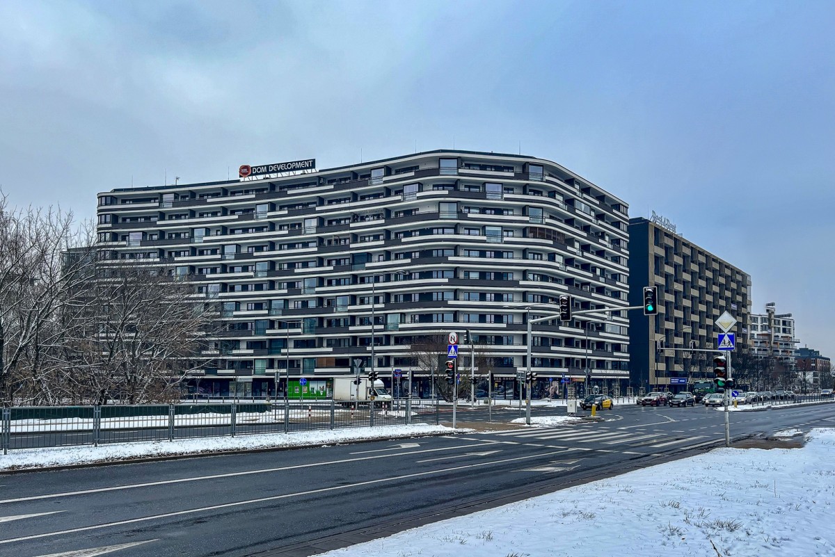
Mokotow. Microdistrict (obszar) „Czerniaków” (Czerniaków)
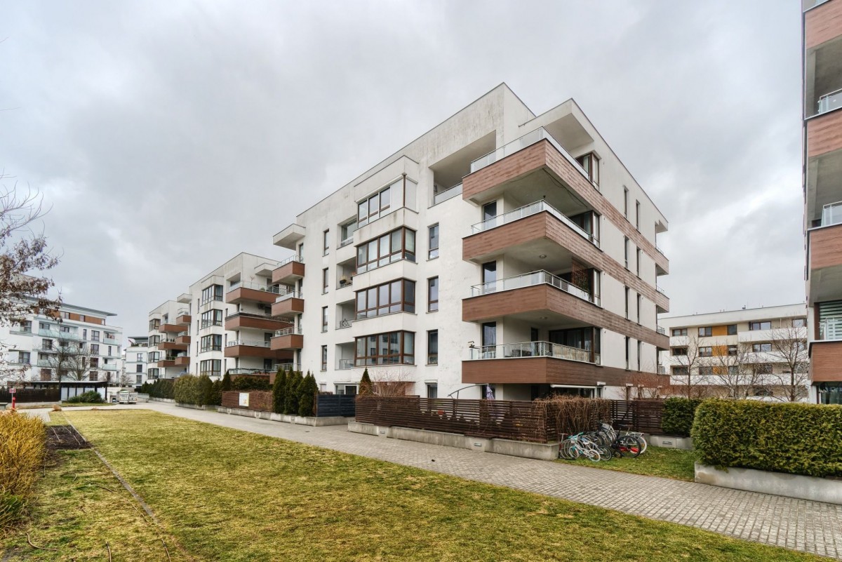
Mokotow. Microdistrict (obszar) „Czerniaków” (Czerniaków)
The boundaries of the Czerniaków microdistrict according to MSI are determined as follows:
Southern fencing of the water pipeline (border of the districts Śródmieście/Mokotów) – Czerniakowska – Witosa – Idzikowskiego – Gołkowska – western shore of Lake Czerniakowskiego – eastern section of the border of the district Czerniaków: from the western shore of Lake Czerniakowskiego further north – al. J. Becka – al. Polski Walczcej – Batalionu AK Batyk, – regiment AK Waligra to the street. Bartyckiej, further along the eastern, then northern border of the garden plots to the border of the Mokotów/Śródmieście districts.
Southern fencing of the water pipeline (border of the districts Śródmieście/Mokotów) – Czerniakowska – Witosa – Idzikowskiego – Gołkowska – western shore of Lake Czerniakowskiego – eastern section of the border of the district Czerniaków: from the western shore of Lake Czerniakowskiego further north – al. J. Becka – al. Polski Walczcej – Batalionu AK Batyk, – regiment AK Waligra to the street. Bartyckiej, further along the eastern, then northern border of the garden plots to the border of the Mokotów/Śródmieście districts.
Czerniaków is divided along a north-south line by Józefa Becka Avenue. Czerniaków borders Ujazdowem, Siekierkami and Sielcami. The main artery is Czerniakowska Street on the eastern border of the district. On the territory of the microdistrict, in its southern part, there is a nature reserve Jeziorko Czerniakowskie (Lake Czerniakowskie).
History of the Czerniaków neighborhood
The village of Czerniakowo has been located in these territories since the Middle Ages and was part of the Soletskiego and then Jazdowskiego parish. This territory probably formed a single whole with Siekierkami and Sielcami. The former noble village was mentioned back in the 14th century. In the middle of the 16th century, there was a water mill in Czerniakowie, and the inhabitants were engaged in agriculture and fishing. Czerniaków was a noble village, which in 1580 was located in the Warsaw County of Masovian Voivodeship.
Czerniaków has changed borders and owners over the centuries. In the middle of the 17th century, Czerniaków was included in the royal domain of Ujazdowa, and at the end of the 17th century, the land was completely transferred to the marshal of the great crown Stanisław, Heraclius Lubomirski. He built a Bernardine church and monastery on the road leading from traktu ujazdowskiego on the banks of the Vistula to Wilanowa, and a wooden manor on jeziorkiem Czerniakowskim. A village stretched between the estate and the church. Czerniaków was connected to Wilanowem by a linden avenue. The property was rented from the marshal's heirs by King Augustus II. At that time, court entertainments and celebrations took place here, as well as parades and military exercises. The wooden mansion was demolished around the middle of the 19th century, and the Czerniaków fort with earthen ramparts and ditches was built near the church in the 80s as part of the construction of the Warsaw Fortress.
The agricultural lands of Czerniakowa were in the past an important source of supplying Warsaw with agricultural products, vegetables and fruits. In 1916, the city of Czerniaków was incorporated into Warsaw. Before the war, it was one of the poorest areas of the city.
During the interwar period, villages of green villas were built in the surrounding areas - the garden city of Czerniaków.
Czerniaków suffered greatly during World War II. During the Warsaw Uprising, the heaviest fighting took place here.
In the 70s of the 20th century, the construction of residential buildings destroyed the remains of the previous layout and the old Bernardyńskiej street. All that remains is the name of the street and the church ensemble, whose magnificent Baroque architecture and extremely rich interior decoration still delight today.
In the southern part of the area there is Jeziorko Czerniakowskie, which was once an important hunting reservoir.
Outside Czerniakowa, as an MSI area, there are objects of the same name: Czerniakowa Hospital - Szpital Czerniakowski (on the border of the MSI Sielce area), Czerniakowa Cape - Cypel Czerniakowski (MSI Ujazdów area and fragmentarily in the MSI Solec area), Czerniakowa Port - Port Czerniakowski (MSI area Ujazdów), settling basin and river pumping station of Czerniakowska - zbiornik osadnikowy and Stacja Pomp Rzecznych Czerniakowska (MSI Ujazdów area), Czerniakowska cemetery - Cmentarz Czerniakowski (MSI Sadyba area), Czerniaków Garden City - Miasto-Ogród Czerniaków (MSI Sadyba area ), Fort IX Czerniaków - Fort IX Czerniaków (MSI Sadyba area)
Real estate in the Czerniaków microdistrict
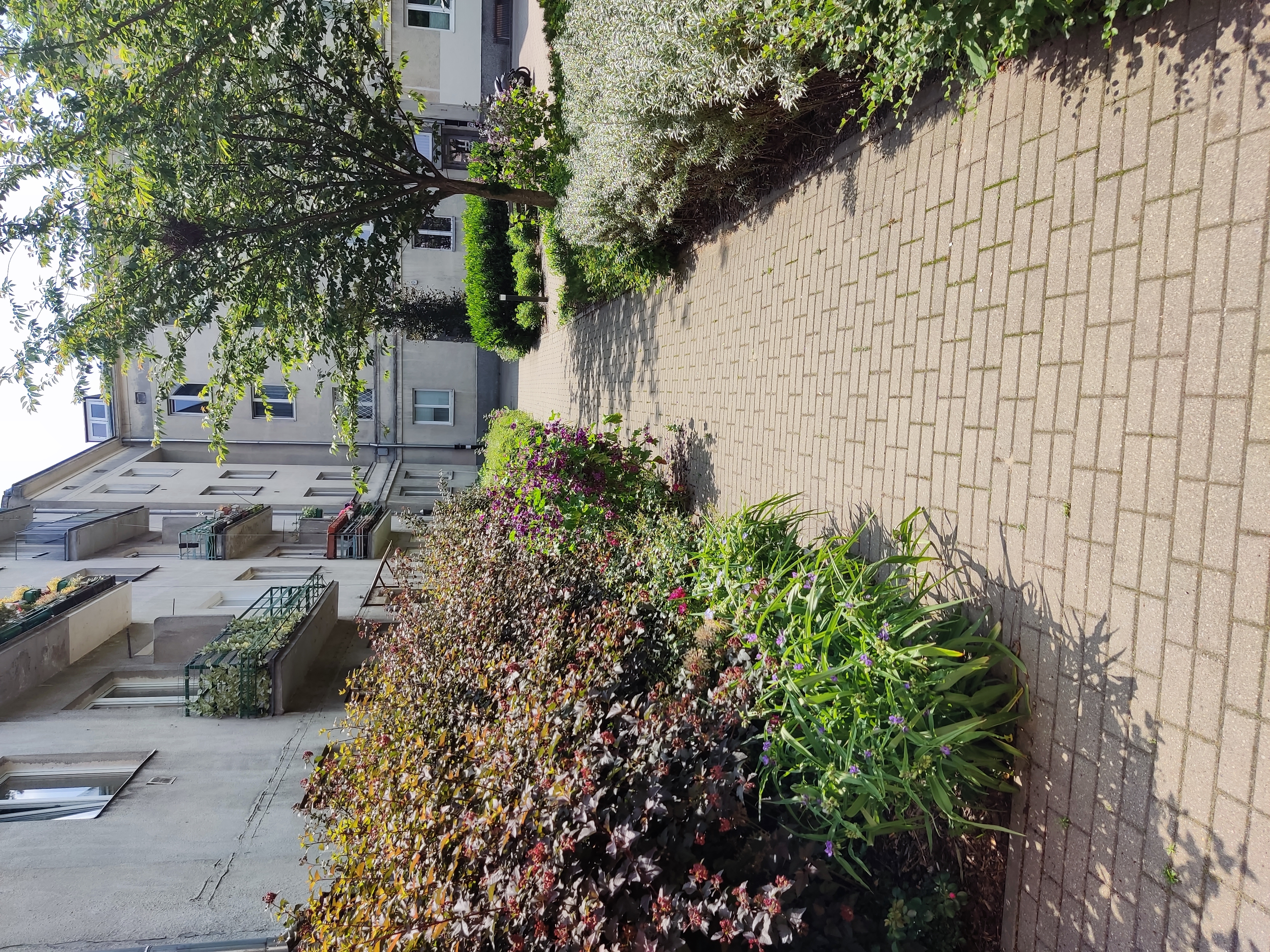
The character of the development of Czerniakowa is varied - there are both single-family houses and villas, but buildings from the 1990s and the first decade of the 21st century predominate. New residential complexes continue to be built. Most of the territory is occupied by private plots located between Trasą Siekierkowską and al. Polski Walczącej.
Czerniakowska Wschodnia or Osiedle Czerniakowska is a village in the Mokotów district of Warsaw. The village of Czerniakowska Wschodnia is located in the west of the region. It is located along Czerniakowskiej street, on its eastern side, between Wolicką and Bartycka streets. The eastern border of the village is partially defined by Zwierzyniecka and Kanał Czerniakowski streets. The village is crossed by Aleja Polski Walczącej. Its area is 21 hectares.
It was built in two stages. The first one was built in 1970-1975. The second was implemented in 1978-1980. A total of 2,633 apartments were commissioned for 9,000 residents. In the village there are apartment buildings of 5, 11 and 16 floors, built using the following technologies: large-block “Ż”, monolithic and N-frame. The buildings are complemented by a school, a kindergarten and a trade and service pavilion. The village is managed by the Interplant Housing Cooperative "Energetika" as part of the Sielce microdistrict.
Residential complex Bartycka Residence
Address: ul. Bartycka , Czerniaków, Mokotów, Warszawa (3.8 km from the center). The facility was put into operation in the 4th quarter of 2009. Finishing standard: developer standard. The Bartycka Residence residential complex has interesting architecture. Low, cozy buildings, surrounded by greenery, are designed to give the feeling of living in a unique environment.
At the first stage, two houses with 14 apartments each were built. There are from two to six apartments per floor. Apartments ranging from 53 to 83 sq.m. are located up to the 2nd floor inclusive. On the 3rd floor there are apartments ranging from 108 to 146 sq.m. with spacious terraces. Extra large windows ensure maximum sunlight in the apartments.
For the convenience of residents, parking spaces in the underground garage are connected to the upper floors by elevators. The complex is closed and protected, 24-hour security. The location provides quick access to the center and other areas of Warsaw.
Transport. Residents of the Bartycka Residence complex can use an extensive network of transport links. The nearest communication point – Budexpo – is 80 meters away.
Education. Residents can benefit from a rich educational offer. There are 16 educational institutions in the immediate vicinity of the Bartycka Residence complex. Nearest: Omega kindergarten 240 m, nursery 410 m.
Health care. A big advantage of investing in Bartycka Residence is the proximity to medical centers. Access to medical care is provided by: Eskulapek at 140 m, Dr. Frank at 450 m, Orto Implantic at 700 m.
Shops and services. The commercial and service infrastructure of Bartycka Residence consists of many points. Nearby, 30 m away is Żabka, 90 m away is Oskroba, 90 m away is Delikatesy Mięsne "Sokołów".
Sports and nature. In the immediate vicinity of the Bartycka Residence investment there is an outdoor gym at 350 m, a sports center at 350 m and a sports ground/court at 370 m. There is a park and a river next to the complex.
Sights of the Czerniaków microdistrict
- The Jeziorko Czerniakowskie Nature Reserve is a water reserve located in the Mokotów district of Warsaw. Formed in 1987. Its central part and main object of protection is Jeziorko Czerniakowskie, from which the name of the reserve comes. The area of the protected zone is 185 hectares, the area of the reserve is 48 hectares, the size of the lake is 19.5 hectares. This is the largest natural reservoir in Warsaw. It is 1780 m long and 100-180 m wide. The average depth is 2.5 m, and the maximum is 3.75 m. The outflow of water is carried out through a covered canal running along the street. Wolickiej. Over the past 60 years, the water level in the lake has decreased by 1 meter.
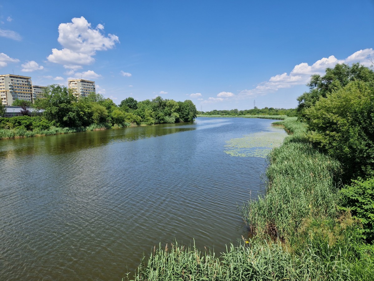
The only official beach in Warsaw is located on the lake. In winter this is a place for winter swimming. Orthodox Christians celebrate the Feast of Jordan here.
- Kościół św. Antoniego z Padwy, located on the street. Czerniakowskiej No. 2/4. Built between 1690 and 1693. At the same time as the church, the Bernardine Monastery was built. In 1864, the Bernardine Convention was abolished, returning here in July 1945. The church and monastery were damaged mainly in 1939 during the defense of Warsaw and in 1944 during the Warsaw Uprising. Extensive restoration work was carried out between 1985 and 1994. This church has never been rebuilt and has retained its original Baroque interior. The churchyard also contains a neoclassical portal chapel dedicated to Saint Boniface of Tarsus, dating from 1839.
- Kopiec Powstania Warszawskiego (Mound of the Warsaw Uprising) is an artificial elevation located in Czerniakowie on the south side of Bartyckiej Street. The idea to build a mound from the ruins of the city in Warsaw appeared in 1945. The filling of the current mound began after 1945; rubble from destroyed Warsaw buildings was brought to Czerniaków. In 2004, for the 60th anniversary of the Warsaw Uprising, the top of the mound was restored and a staircase was built to provide easy access from the street. Bartyckiej. In the same year, the mound received its current name. A monument is erected on the mound - a symbol of Fighting Poland. Traditionally, on August 1, the anniversary of the start of the Warsaw Uprising, celebrations are held on the mound at 21:00.
The Warsaw Uprising Mound is part of the six Korony Warszawy hills. There is also a trail around the mound, which serves as a recreation area. It is especially attractive in snowy winter. From the top of the mound you can admire the panorama of Warsaw in the southern and western directions.
- Wooden house of the 19th century, st. Bernardyńska, 1.
- Katedra Świętego Ducha (Cathedral of the Holy Spirit) - the main temple of the Polish Old Catholic Church, located in Warsaw on the street. Szwoleżerów, 2, at the intersection of this street with Czerniakowska Street. It was erected as an Orthodox military church in Warsaw. It remained so until most of the Russian population left the city in 1915. During the interwar period in the 20th century. It was the garrison church of the 1st Szwoleżerów Józefa Piłsudskiego Regiment. Since 1945 it has been in the possession of the Polish-Old Catholic Church as its cathedral. It is also the seat of the Warsaw Parish of the Holy Spirit. Built at the end of the 19th or beginning of the 20th century.
Social sphere of the Czerniaków microdistrict
Transport in the Czerniaków area is concentrated along Czerniakowskiej Street, from where you can reach other parts of Warsaw both by car and by bus. Buses run along the small streets of Czerniakowa. The routes are very long and sometimes delayed due to traffic jams.
In Czerniakow there are district kindergartens (two on Czerniakowskiej Street) and a primary school (on Zwierzynieckiej Street).
The Akcji Burza park and the Powstania Warszawskiego mound are places of recreation for residents of the Czerniaków microdistrict.
Sports enthusiasts living in the Czerniaków microdistrict have the opportunity to train in running at the Powstania Warszawskiego Mound. Just beyond the Czerniakowski port, a bicycle path along the Vistula begins, along which you can get to the town of Łomianki. For fans there is a football field and a tennis court. Fitness clubs are located in neighboring areas, the nearest swimming pool is in Warszawiance.
In the Czerniaków neighborhood, shopping can be done in local shops and popular discount stores, but the real potential of the area is the sale of building materials. On Bartyckiej Street there are several dozen shops and wholesalers selling repair and construction materials. The gastronomic map of Czerniakowa is also not rich.
The district primary health care clinic is located on the street. Czerniakowskiej, but already on the territory of neighboring Sielców. There are no medical offices or access to medical care in the Czerniaków microdistrict itself.
Gradually the neighborhood begins to develop on the border with Siekierkami with new investments. Czerniaków is an interesting accommodation option for people who want to live in silence and be close to the center.
Blog
Housing prices in Poland in the fourth quarter of 2023
Housing prices in Poland in the fourth quarter of 2023
Poland in the world ranking of rent growth
Poland in the world ranking of rent growth
